The house
607 Halsey Street
A late-19th-century Brooklyn row house
The basics
What we’ve learned
After signing the contract, we wanted to learn more about the house and the neighborhood. Here’s what we’ve found in old maps, photographs, and city records.
The house is on the north side of Halsey Street, between Malcolm X Boulevard (formerly Reid Avenue) and Patchen Avenue. City records list an approximate construction date of 1899.
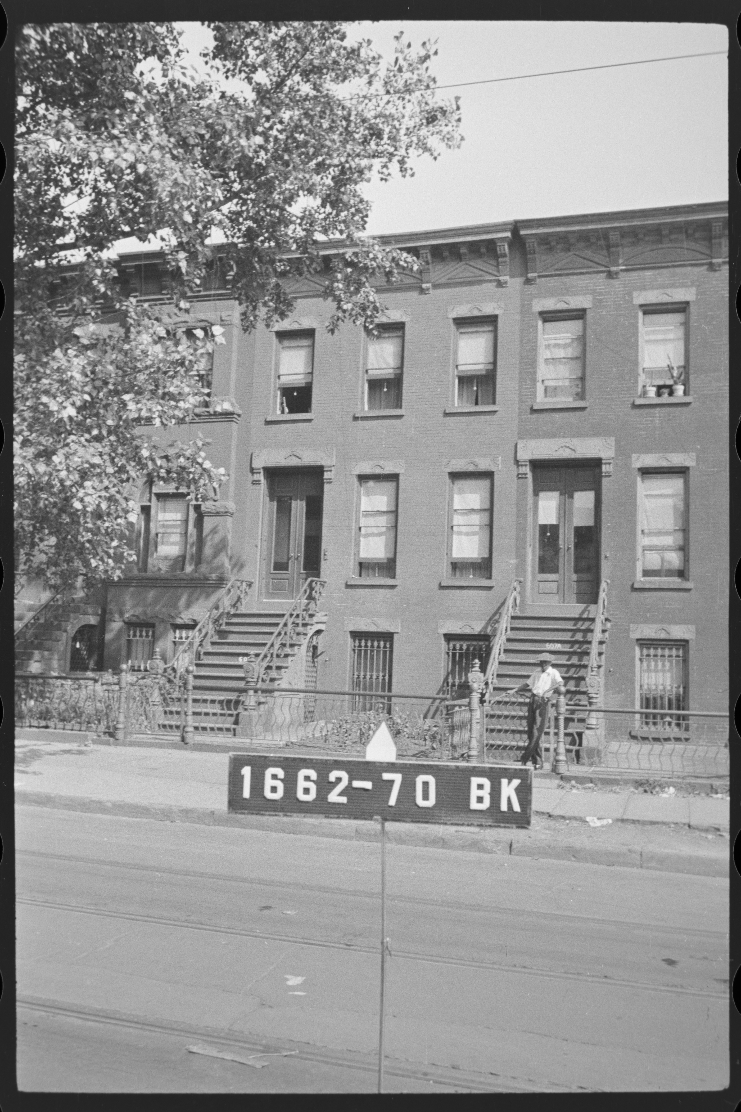
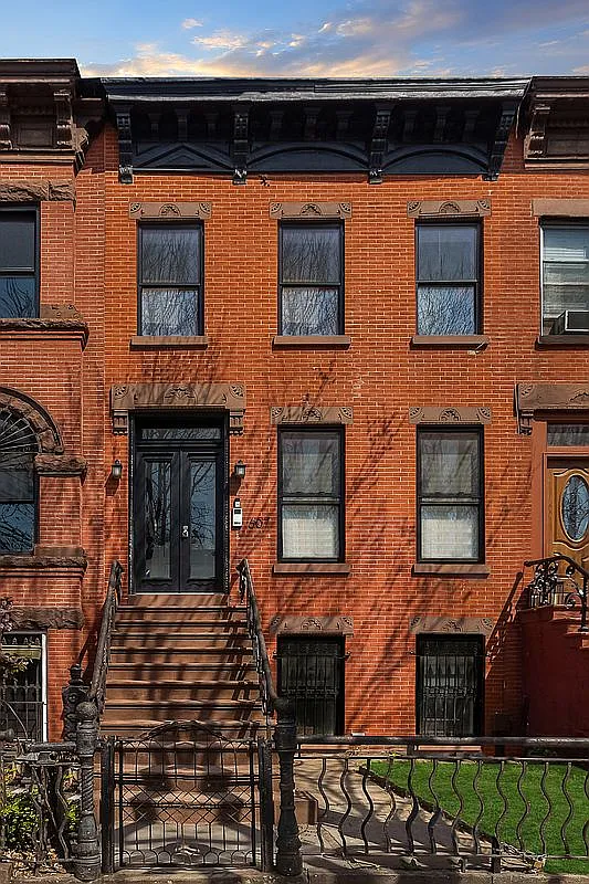
The house shares many features with its Bed-Stuy neighbors: a brick facade, a high stoop, and decorative details above the windows.
Research sources
The maps we used
We used the Hopkins atlas and Sanborn fire-insurance maps to learn how the blocks around 607 Halsey developed.
Sanborn fire-insurance maps
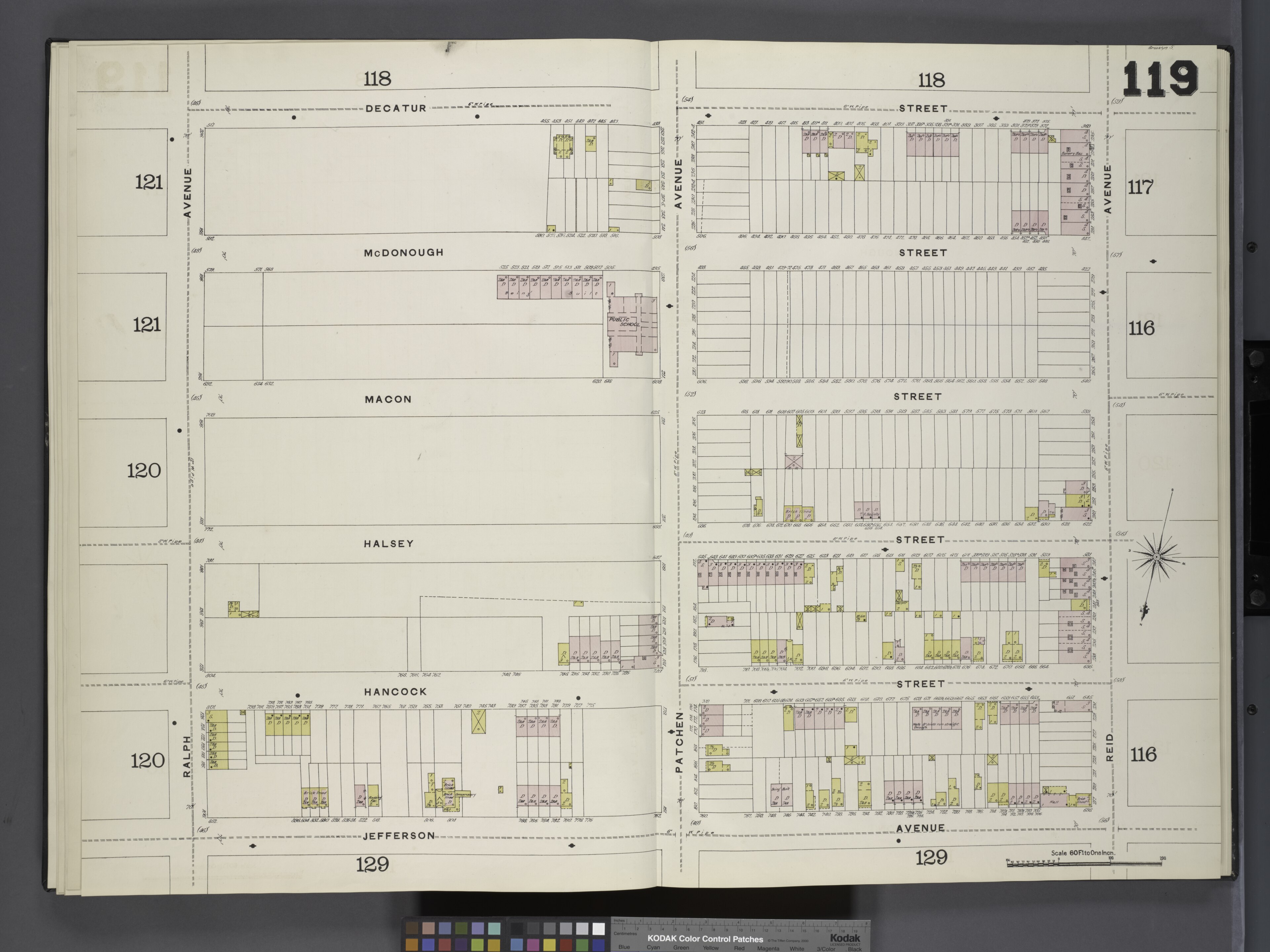
The Sanborn fire-insurance maps were made for insurance companies. They show building materials, property lines, and how buildings were used.
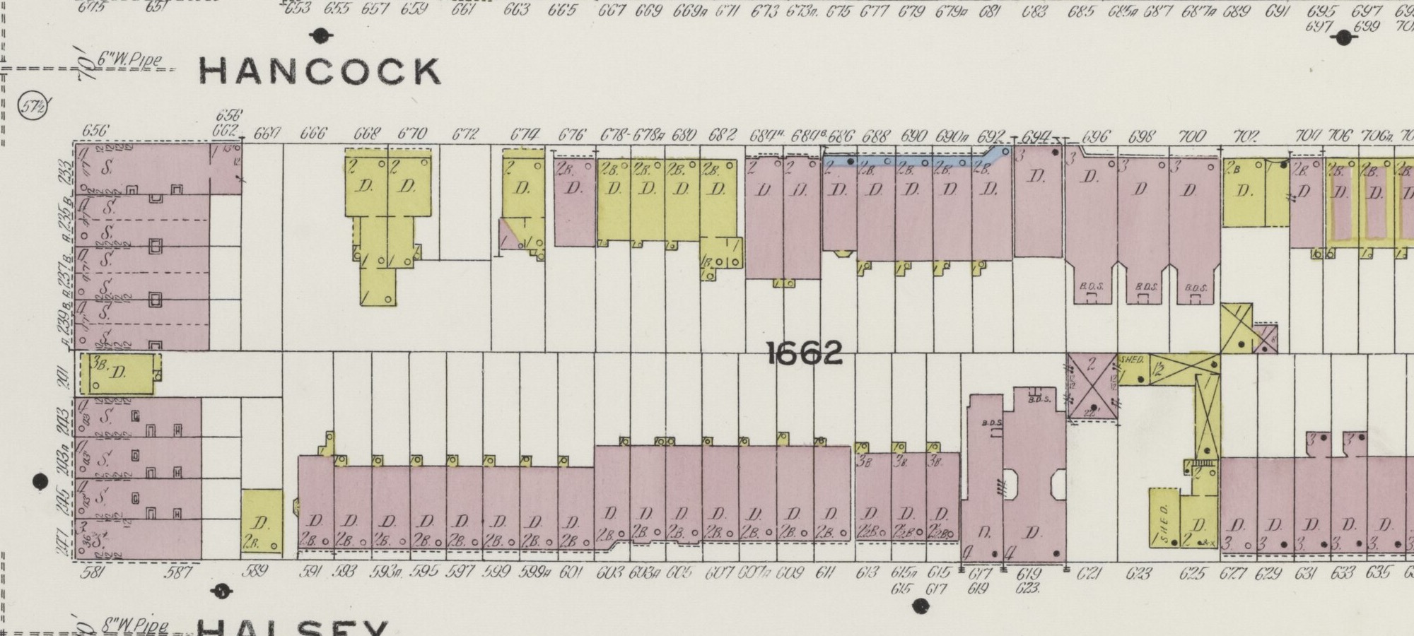
Comparing the 1888 map and 1908 map helps us see how our block changed.
Hopkins atlas
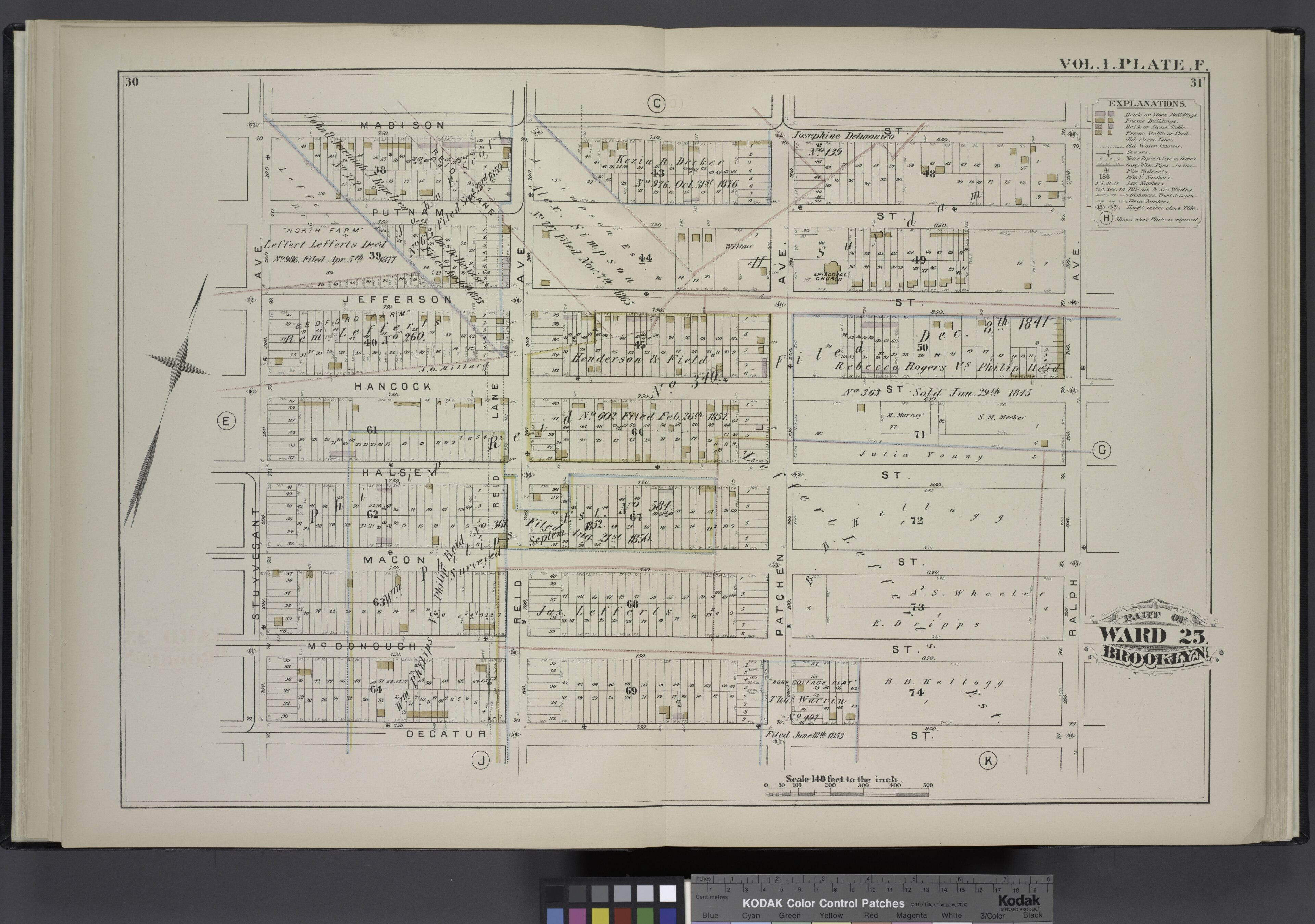
The Detailed Estate and Old Farm Line Atlas of the City of Brooklyn was published by G.M. Hopkins & Co. in 1880.
The atlas shows streets, property boundaries, and older farm lines around Halsey Street, before the block was fully developed.
1880-1908
How the block developed
The maps show how our block changed as this part of Brooklyn grew. For the broader history, see The neighborhood.
The 1880 Hopkins atlas shows the street grid, lot lines, and older farm borders around Halsey, Reid, and Patchen. The area was already mapped into city blocks, but not yet fully built out.
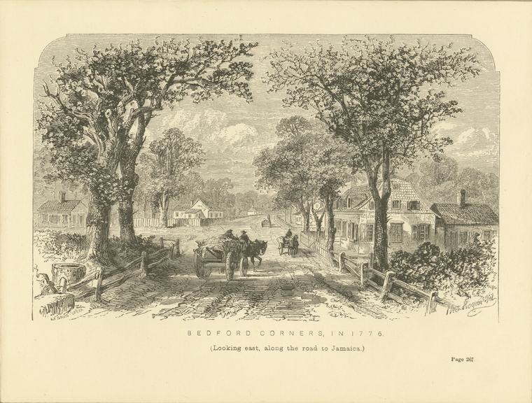
The 1888 Sanborn map shows little development near the future house site. By the 1908 Sanborn map, a continuous row of brick houses lined this side of Halsey Street. That sequence fits the city’s approximate 1899 construction date. Though the neighborhood took decades to fully develop, much of Bed-Stuy transformed from farms to residential blocks within a lifetime; the pace of change must have seemed astonishing at the time.
1899-1908
The house on the 1908 map
On the 1908 Sanborn map, the house is marked as a brick dwelling. The letter “D” stands for dwelling.
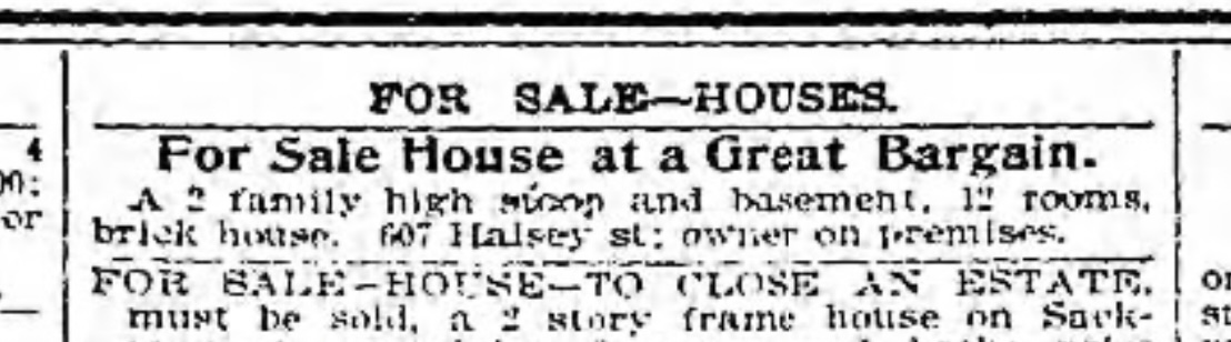
We found an 1898 Brooklyn Daily Eagle advertisement that may refer to 607 Halsey. We haven’t confirmed the match, but it could be an early sale notice for the house.
1960s-2026
Previous owners
So far, we’ve found records of at least eight owners or ownership groups before us. The records before 1960 are less clear. We’d like to explore the older deeds to learn more.
1940s and 1980s
Two city photographs
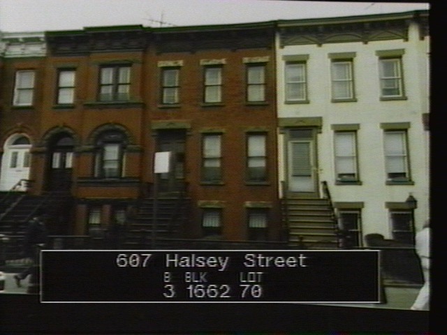
The Department of Finance photographed New York City buildings in the early 1940s and again in the 1980s. Both series include 607 Halsey Street by block and lot.
The earlier photograph clearly shows the stoop, ironwork, window details, and cornice. The 1980s photograph is less sharp, but gives us another view of the house several decades later.
Halsey Street
Halsey Street
Halsey Street runs east-west through Bedford-Stuyvesant and Bushwick toward the Brooklyn-Queens line. Secondary histories connect the name to James Halsey, a colonial-era developer and possible relative of Stephen Halsey of Astoria.
Street histories record horsecar service along Putnam Avenue and Halsey Street by 1870, Halsey Street cut through toward ball grounds in 1889, and early 20th-century institutions and businesses scattered along the corridor. The house belongs to that broader story: a domestic address on a street that carried transit, theaters, churches, schools, and everyday Brooklyn life.
Sources
- NYC Department of Finance tax photographs, 1939-1941 and 1983-1988.
- NYC Department of Buildings BIS property profile for BIN 3046253.
- NYC ACRIS index records and document references for known ownership eras.
- NYPL / Wikimedia Commons Bedford Corners, in 1776, Hopkins 1880, Sanborn 1888, and Sanborn 1908 image and map plates.
- Eugene Armbruster street notes on Halsey Street and the old Lefferts farm house at 22 Halsey Street.
- NYC PLUTO and public property records for physical property identification.